Hydrogeology and Hydrology of the Kern River Parkway
Bakersfield was not always the parched land we know it as today. In the time before Baker’s field became famous, the southern San Joaquin was a swampy wetland subject to regular floods that redirected the Kern River flow more than once.
Colonel Thomas Baker and others drained the swamps, making the land habitable for settlers, although flooding, malaria, and yellow fever were still problems.
The current Kern River, which has its headwaters near Mt. Whitney, is a shadow of its former self. The dam that created Lake Isabella in the 1950s, combined with the seven weirs that divert water from the river starting at the mouth of the Kern Canyon, have reduced the Kern River to a trickle.
One unique feature of Bakersfield’s hydrogeology is the alluvial fan which spreads out from the mouth of the Kern Canyon. The alluvial fan causes water runoff from the Sierra Nevadas to run into the valley where is slowly seeps down into the natural aquifer. The City of Bakersfield’s “2800 Acres” water recharge project lies at the western end of the Kern River Parkway.

Map of the Kern River Delta, 1896 Kern County Land Company; Britton & Rey [Public domain], via Wikimedia Commons
You can find much more about the hydrogeology of the Kern River here.

Kern River and the Pioneer Canal 1890 Miscellaneous Items in High Demand, PPOC, Library of Congress [Public domain]
Interesting article about early Bakersfield settlement and efforts to control the Kern River.
Link to the 1877 Canals map. Note the lake in downtown Bakersfield!
Kern River nearing the alluvial plains 1890 Miscellaneous Items in High Demand, PPOC, Library of Congress [Public domain], via Wikimedia Commons
More historical Bakersfield information, including the many floods that once occurred.

Kern River on Rio Bravo Ranch 1890 Miscellaneous Items in High Demand, PPOC, Library of Congress [Public domain], via Wikimedia Commons
The Bakersfield Water Resources Department created an informative and interesting booklet about the 1976 purchase of Kern River rights by the city of Bakersfield.

Kern River above Calloway Canal north channel, 1890 Miscellaneous Items in High Demand, PPOC, Library of Congress [Public domain], via Wikimedia Commons
Information about water banking here.
Huell Howser visited Bakersfield’s “2800 acres” water baking project for an episode of his show, California Gold. Watch the episode here.
Petrolium development on the Kern River, 1910 https://www.loc.gov/pictures/item/2007660534 [Public domain], via Wikimedia Commons
City of Bakersfield’s document about the Kern River Flow
Headgate of Kern Island Canal (left) Stine Canal (right)
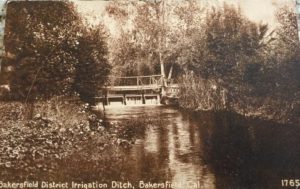
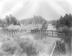
Bakersfield Irrigation ditch, unknown location, probably near base of the Panorama Bluffs.